While not isolated per se- the island is located in close proximity to the population centers of Quincy and Hull- Peddocks does feel desolate. I was fortunate enough to visit Peddocks Island last Saturday, a cold, early spring day. Like all the harbor islands, this one is full of beautiful views and historic places. The view from the bluffs of Peddocks Island to the East is an impressive and unobstructed one:

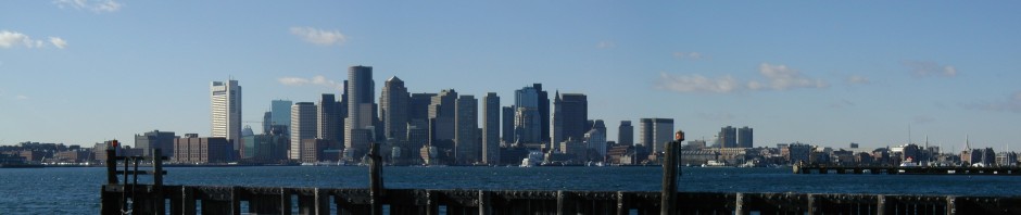
A view from Peddocks facing West, back toward the city of Boston over the post-winter landscape of dry, scrubby bushes and brown grass:

Peddocks is one of the largest Islands of Boston Harbor and has a history dating back to pre-historic times, as remains of ancient human inhabitants thousands of years old have been discovered on the island. A nautical chart of Peddocks Island today and its location in the Southeastern part of Boston Harbor:

NOAA Nautical Chart. See disclaimer at NOAA.gov
While not isolated per se- the island is located in close proximity to the population centers of Quincy and Hull- Peddocks does feel desolate. The desolate and abandoned feel of the island comes from the ruins of its former military operations- Fort Andrews in particular. This fort was built in 1897 and was named after George Leonard Andrews, a Civil War soldier and engineer who helped design Fort Warren on Georges Island. It is not to be confused with Fort Andrew, located at Gurnet Point. Given Boston’s exposed position on the North Atlantic, securing the harbor was a key strategic initiative during WWII, hence the active usage of Fort Andrews during that time. Built in 1897 and used extensively until the end of the second World War, Fort Andrews occupied most of the North side of the Island. The empty military barracks and the church show that there was once a thriving community here:

It is in this way that Peddocks is an extension of the South Shore: Located far from the city of Boston, it lies just more than a stones throw from Pemberton Point on Hull across Hull Gut to the Northeast, and only a few hundred yards from Nut Island on Quincy’s Hough’s Neck to the Southwest. It is not isolated like the Islands of Outer Brewster, Calf and Green several miles to the Northeast….just desolate.
While the remains of Fort Andrews occupy most of the Northern end of the Island today, the middle parts are occupied by a small number of year-round residences. Below is a photo of the abandoned army barracks:

A former mortar battery, now abandoned for more than half a century:

The mortar battery from the tunnels inside:

The small courtyard on the far side of the battery:

The gun stations on the bluffs of the North side of the Island, which were the primary fortifications of Fort Andrews.

The center of Fort Andrew’s former military operations:

Remnants of Fort Andrews’ day to-day operation now lie in ruins:

Lots of old rusty junk accumulates on a beach that is not often walked by visitors.

A view of the Western side of the island looking South to Portugese Cove, where there are still some year round inhabitants:

Peddocks Island will be open to the public this summer for the first time in several years. One can visit through one of the cruise companies or by private boat.


