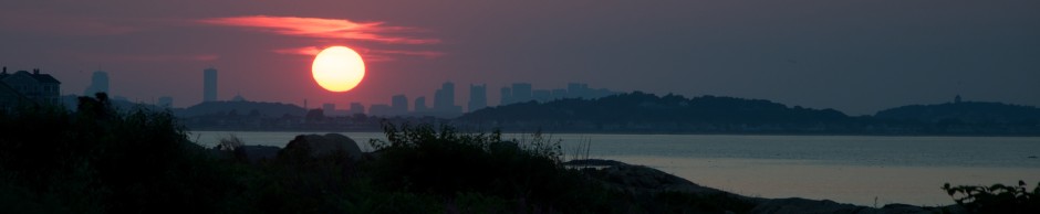
The Neponset area located south of Boston offers some lovely views from boat or land, as one can see in this city view from the estuary where the river meets Dorchester Bay:

When thinking of rivers near Boston, The Charles comes first to mind for most. A little less known in the Neponset, which many communities South of the City of Boston are built around, particularly Dorchester’s Lower Mills and Milton. While in close proximity to urban area-and even crossed by highway and rail- this area is a marshland, full of aquatic life and waterfowl. A view of the Marshlands around the Neponset River from high on a hill in North Milton, below:

Aside from the Charles there are at least six other major rivers flowing into Boston Harbor. These include the Mystic, the Malden, the Chelsea, the Weymouth Fore and Back Rivers, and the Weir River in Hingham. Bring that number up to at least eight if you want to include Quincy’s Furnace Brook and Winthrop’s Belle Isle Marsh creek as rivers. The Neponset is likely the second largest river into the Harbor in terms of discharge volume, and is one of the cleanest. It’s watershed is unique versus the other major rivers as it is surrounded by marshland, creating a viable habitat for all types of wildlife. Efforts to improve the Herring population, once a staple of the river but now endangered are ongoing. Looking South along the Neponset’s Marsh area from Granite Ave:

Below is a chart clip of the Neponset as it hits Dorchester Bay on the Southwest side of Boston Harbor. Navigable by boat to at least the Bridge at Granite Ave, boaters should use caution and preferably go at high tide. A trip up the Neponset is ideal for one of those windy summer afternoons where the wind chop in Boston Harbor builds to an uncomfortable height.

*NOAA Nautical Chart. Not for official navigiation. Disclaimer at www.noaa.gov.
Upon traveling upriver, one can reach Dorchester Lower Mills, the end point of the portion of the river navigable by boat. This is a well preserved part of Boston history that is less well known to outsiders and tourists:

The dams at Dorchester Lower Mills, in which the river was used for factory production during America’s 1800s industrial revolution. Many of these structures, most notably a Chocolate factory, are still occupied today. Several have been converted into high end condominiums and have been maintained beautifully.
 The yacht club at Neponset Marina, which is just about as far as boaters can navigate up the river from Boston Harbor:

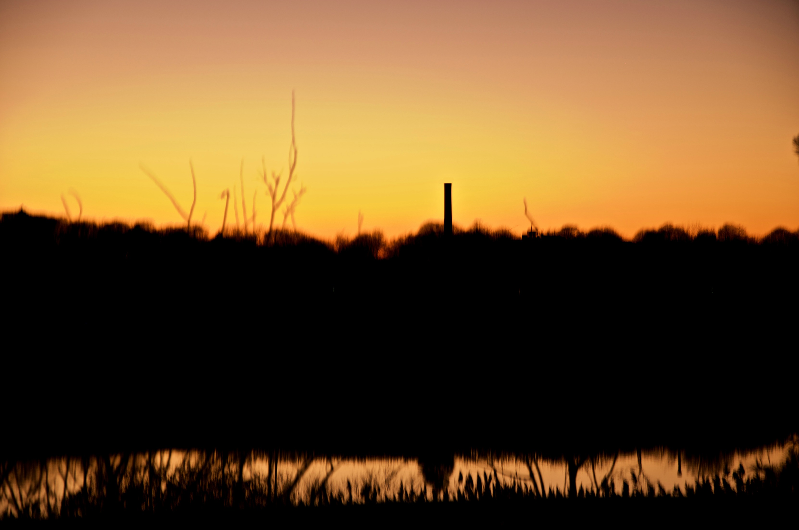
Further down river at the marina near Granite Ave, as boats and docks are stacked for the winter before they go in the water for the season. From this vantage point, one can see the wide marshes adjacent to the river. Just beyond the marina upriver is the intersection with Gulliver’s Creek, where the old stone remains of the Granite Railway loading dock can be seen. Below, the smokestack from Dorchester Lower Mills is visible in the distance:

Looking over the Neponset River at dusk, as seen from the Granite Ave intersection:
Near the point where the river winds from Milton into Quincy on its East Bank is the Neponset River Bridge and a nearby rail bridge supporting both the MBTA red line and commuter rail. To the South of these structures is Pope John Paul II park, while to the North is Port Norfolk Tenean Beach and the Squantum section of Quincy. Below is a view looking north from on top of the bridge. One can see the remains of some old structures on the west side of the river, which was the Lawley Shipyard and before that, the Putnam Nail Factory.

Further downstream, the Neponset opens up into Dorchester Bay, the Southwest corner of Boston Harbor. The landmark Boston Gas tanks jut out into the harbor at the mouth of the river. The last stretch of the river has some deceptively shallow waters than can be dangerous to navigate near low tide.

Places to view the Neponset from land: Seen below is the running trail from Granite Ave to Lower mills. Running adjacent to the red line extension between Ashmont station and Mattapan, this is a great spot to walk alongside the river. A parking lot is located off Granite Ave, near the lift bridge. Another place to see this Pope John Paul II park, the entrance to which is on Gallivan Blvd. in Dorchester, right before the Neponset Bridge to Quincy on Route 3a.

The lift bridge near Granite Ave. Navigation by boat past this point may get tricky, especially near low tide. See the nautical chart clip above for reference. It was not far from this area where the Quincy Granite Railroad met the river and stones were loaded onto barges.

Hopefully, you will be able to make a trip to see the Neponset, either by boat or on foot, soon!


