Lying between Long island and Peddocks Island, Rainsford Island is located in a relatively calm open area in the middle of Boston Harbor, just north of Quincy Bay. Once used as a quarantine station, this a centrally located but very small island in the middle of the harbor. It is said that the island derives its name from Edward Rainsford, who owned the island in 1632. The island has no remaining structures except the foundation of a quarantine hospital and seawall on its exposed Northeastern side. With no public dock or ferry service, Rainsford requires a private boat to access. Below is a view of Rainsford Island looking west on a rainy spring day, with Long Island’s water tower is visible in the distance:

An Eastward-looking view from the top of Rainsford Island’s North Drumlin.

The most prominent part of Rainsford’s history is its role as a quarantine station and hospital: Ships arriving from international destinations were required to unload passengers who would sit at quarantine before entering the city. Here, quarantined patients would wait until they either recovered or died. Several nearby features are named for the quarantine station: These include the Quarantine Rocks, a dangerous line of rocks located South of the Island, and the Hospital Shoal, a shallow area north of Rainsford which is popular for fishing. The location of the quarantine rocks and the Hospital Shoal can be seen in the NOAA chart of Rainsford Island below:

Source: NOAA nautical chart. See disclaimer at NOAA.gov
Below are the quarantine rocks, Looking back towards the city of Boston, with the low lying section of Long Island in the foreground, Spectacle Island’s drumlin behind that, and finally the city skyline.

This stone cross sits near the top of Rainsford’s North drumlin. While it is not labeled, perhaps it is a memorial to someone who died while waiting at the quarantine station:

A beach covers the narrow spit between the two bluffs, which offer shelter. This is a popular place among kayakers and is also evidently a popular place for Graffiti:

Terns sit perched upon the remaining pilings of the old pier at Rainsford. Here is a photo from the Boston Public Library of how the pier once looked. The remains of this pier are a navigational hazard: While well marked on charts, the pilings are lie just below the water and are mostly not visible at high tide. See the chart above for location:

Aside from the island’s history as a quarantine station, it was used extensively as a reform school for boys in the early 20th century. The school was called the Suffolk School for boys and was closed in 1920s. Below is a photo of the school grounds which shown the contour of the island. A full photo stream is available at the Boston City Archives flickr page. The photo is taken from the southern bluff looking toward the north bluff, with the protected sandy cove in the center. Note that the wharf is visible on the far right of the photo: that wharf lies in ruins today but its remains are still visible (such as in the photo above).
 Photo listed as a public domain work with the following citation: Children’s Institutions Department lantern slides, Collection #8500.002, City of Boston Archives, Boston
A present day view from the exact same spot:

A more obscure part of Rainsford’s history is that it used to be home to a well known lobsterman’s shack called Portuguese Joe’s, which is was on the south side of island near quarantine rocks. One night in June of 1938, the shack burst into flames in a conflagration that could be seen for miles. Police received so many calls about the blaze that reports of the incident made it into the papers in subsequent days.
The dunes of Rainsford’s Northwest side, with Long Island in the background. The area between Rainsford and Long Island is an ideal place for a small motorboat on most days. The area is protected from Southwest wind chop by Long Island’s high dunes, and is protected from open ocean’s swell by Georges and Lovells Island islands to the East.

Another view of the city behind quarantine rocks on the south side:

The island’s smaller south bluff:

Rainsford Island is a popular with boaters, not just for fishing at hospital shoal but for anchoring and swimming as well. It probably would not be my first choice of islands to visit due to its small size and relatively central location. However, there are some interesting historical sites to explore and stories around them. There is a great overview of these posted at New England Folklore.
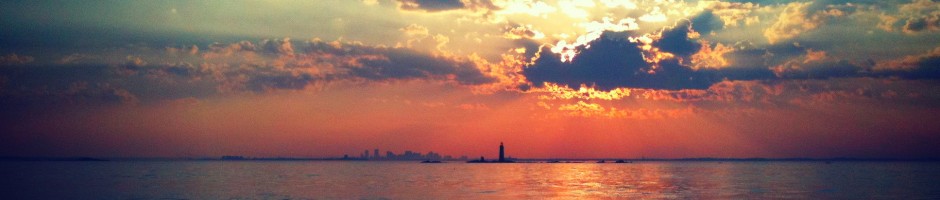
Rainsford Island from Hospital Shoal at dusk:


