Closed to the public for health concerns relating to the presence of asbestos, Gallops Island continually remains a question mark in the minds of Boston Harbor visitors. Due to its central location, one cannot help but cruise by and see the foreboding orange signs telling you not to go ashore (By contrast, Long Island-the forbidden island,-does not have quite as may such signs, but they do have uniformed officers who will see to your prompt departure). Gallops Island was very active up until WWII, and was named for John Gallop, a 17th century trader who inhabited the island and was quite an intrepid and hardened figure according to the description put fourth by Edward Rowe Snow.

The island is located between Long Island and Lovells Island, but also has off to its Western shore the treacherous place known as Nix’s Mate. Off to the East is the narrows, a deep but protected channel connecting the main Boston Harbor shipping channels of President Roads and Nantasket Roads. Below is a photo of the pier at Gallops, as seen from nearby George’s Island. Long Island is visible in the backdrop.

The island is not open to the public due to contamination concerns. Evidently, Asbestos was used in some military structures dating back to WWII, and the government has therefore shut down access to the island until remediation has been completed. The government expects to have this done in the next several years (i.e. don’t hold your breath)…If other government sponsored projects along the harbor are any indicator; lets say for example, the repair of the Long Island Bridge or the dock at George’s Island, we will be waiting for a long, long time. Once open ,this island will be ideal to visit given its central, protected location and nice south facing beach. Being a good, law abiding citizen, I have not ventured in past the beach at Gallops, but I noticed that there is a structure on the island which is visible from shore.

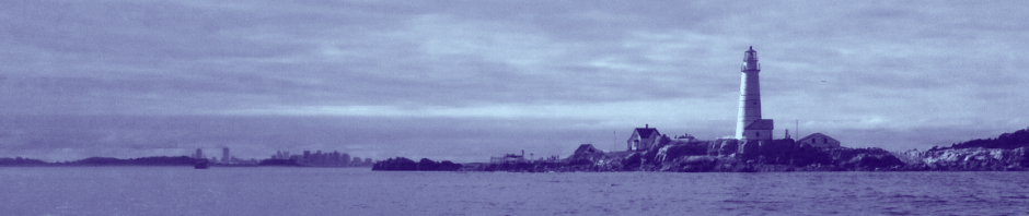
A distant view of Gallops Island (far left) against the large #5 green can east of George’s Island in the foreground, and the city of Boston in the background:

The late season foliage decorates the Eastern edge of Gallops. Heavy green vegetation falling to the ground exposes tangled webs of sumac underneath. I can’t see any asbestos here. Can you?
 Looking East, one sees the seawall of Gallops in the foreground, with the north head of Lovells Island in the Background:

A view of Nix’s Mate at low tide (deadly!!) off the Western side of Gallops Island:

Gallops Island, and the long jetty on its eastern side, as seen from across the narrows at Lovell’s Island. This high point were the photo was taken was the top of Fort Standish:

A chart of the area, showing the central location of Gallops, just west of Lovells and Georges Islands. Note Nix’s Mate to the north:


“A view of Nix’s Mate at low tide (deadly!!)…”
Is it the currents, too, besides the shallows/shoals that make it deadly?
A good question that I don’t have a great answer to. With a powerful motorboat, currents are not as much of an issue. But if you are in a Kayak, they might be an issue. Any time you have a large amount of water flowing through a narrow opening, there is a potential for strong currents. But the shoals are the main issue- just look at all the accidents that have happened out there!
And I do use the use the word “deadly” with some exaggeration….but it could very well be for those not demonstrating nautical skill and using utmost caution.
It is so unbelievably sad that Gallops Island is still closed after 15 years with no re-opening in sight. I will be writing my Govenor, US Senators, State Senators, Congressman and State Reps. I know that it costs money to get this beauty up and open to the public again, but if we can give monetary bail outs to every US business and every other country under the sun, we should be able to find the money for some home grown love!
My Civil War ancestor, 2nd Lt. John Freeman Shorter, with the 55th Mass. USCT, returned Sept. 20, 1865 on the steamer “Ben Deford” to Boston via Gallops Island. Are there any photos (maybe even historic ones) of the island?