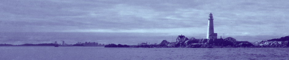
At the Northeastern most edge of the outer Boston Harbor lies Calf Island, with the rocky outcrops of Little Calf Island and Green Island just to the North. Free from development, and highly exposed to the open ocean, these places are inhospitable, rocky landscapes, with weathered vegetation clinging to the rock above a fierce sea. The Eastward view of this place wild, and is quite a striking contrast to the City to the West.
An autumn view from Calf Island, with the dunes of Great Brewster Island to the South:

The fall is a perfect time to visit Calf Island. The abundant growth of sumac on the island turns bright orange and red, creating a striking contrast against the blue and gray sea. The island’s many Seagulls, aggressive and protective of their eggs during nesting season are now hardly present. Having seen their chicks hatch and grow, the birds have moved on to other places, such as Sullivan’s at Castle Island, where they are known to prowl for dropped french fries and rummage through the trash.
With the North entrance of the Harbor at Deer Island extending far a less distance East than the South side at Hull, the Northeastern islands are far more exposed to open ocean than points South. North of Calf and Green opens the Broad Sound, extending across to Graves Light and up to Nahant. In fact, these islands are so close to the North Shore that one can gaze across and make out the details of Egg Rock East of Nahant. Below is a view of Graves Light from the rocky shoes of Calf Island:

On the southwest side of Calf Island lies a small but beautiful sandy beach that is well protected from the ocean’s swell. The west side of the island is made up of small protected coves and steep drops, ideal for anchoring close to shore. There is a small wreck of a barge on the middle of the western shore. At the north side of the island, there is a spectacularly strange rock outcrop– a pleasant foreground to the distant views from this point of Little Calf, Green and Graves Light. The East side of the island is a gradual and rocky ledge, that exposes acres of tidal pools and seaweed at low tide, reminiscent of points much further north along the Maine Coast. Calf island is one of the most effective barriers protecting president roads channels from the open ocean given its long north to south location of close to a mile. Without its presence, the inner harbor would undoubtedly experience more exposure.
Calf Island is particularly notable for the large chimney, which stands alone atop old ruins and is visible for several miles. As older nautical charts will indicate, there was recently two chimneys on the island, the second destroyed in the past few years. The home was the summer house of actress Julia Arthur and her husband. A picture of it in its better days can be seen here. Two photos of the chimney seen up close:

The Chimney, with the ruins of the old foundation visible in the foreground:

A path through the sumac trees on calf island:

Looking East towards Middle and Outer Brewster on the East Side of the Island. This shore of the island is very rocky and shallow. Several major rock outcrops, including Pope Rock (see below) extend out from here. The channel between the West side of Middle Brewster and Calf is rocky and treacherous, but is possible to navigate at high tide in a small boat.

Looking west toward the city from the ruins of an old balcony on Calf Island:

A view of the Calf Island ruins from just offshore gives better perspective. The small beach on the southwestern side of the island is visible here has well. This was taken earlier in the season (note the light green spring foliage):

Pope Rock, a dangerous outcrop jutting out to the East of Calf Island. “Pope Rock” was named for Frederick Pope Jr, who operated a lumber and ship building operation at Commercial Point in Dorchester. One of his cargo ships built at Dorchester was said to have wrecked on this rock in a storm, and so henceforth, this treacherous obstruction was known as “Pope Rock.” We know this bit of information from “A History of the Pope Family, 1634-1888” by Charles Henry Pope. The Pope Family was one of the original settlers of Dorchester, which was only the third in Massachusetts history, following that of Plymouth and Cape Ann. Later, Frederick Pope’s Grandson, Colonel Albert Pope, a famous resident of Jerusalem Road in Cohasset, would go on to be a highly successful entrepreneur in the bicycle industry.

The large rock outcrop at the North side of the island, with Outer Brewster Island visible in the distance:

Calf Island as seen from the heights of Fort Revere in Hull, far above. Its landmark chimney, visible below if you look carefully, makes it recognizable. Great Brewster Island and the Brewster Spit are visible in the foreground, while Salem Sound and the smokestacks of the power station are visible in the distance:

One of several photos of sunset over the mainland as seen from out at Calf Island:

Just a few hundred yards off to the north is Little Calf Island, which is really just a large rock between Calf Island and Green Island. The area between the two Calf Islands is not passable by boat due to rock ledges, but the Hypocrite Channel to the North, between Little Calf and Green Island is:

Green Island is a small barren island located at the far northeastern corner of the harbor. This area is very isolated and from the mainland. Below is a view of Green Island looking north from Hypocrite Channel. Half tide rock, one of the most dangerous places in Boston Harbor is visible in the foreground, while the beach on the south side (and Graves Light) are visible in the backdrop:

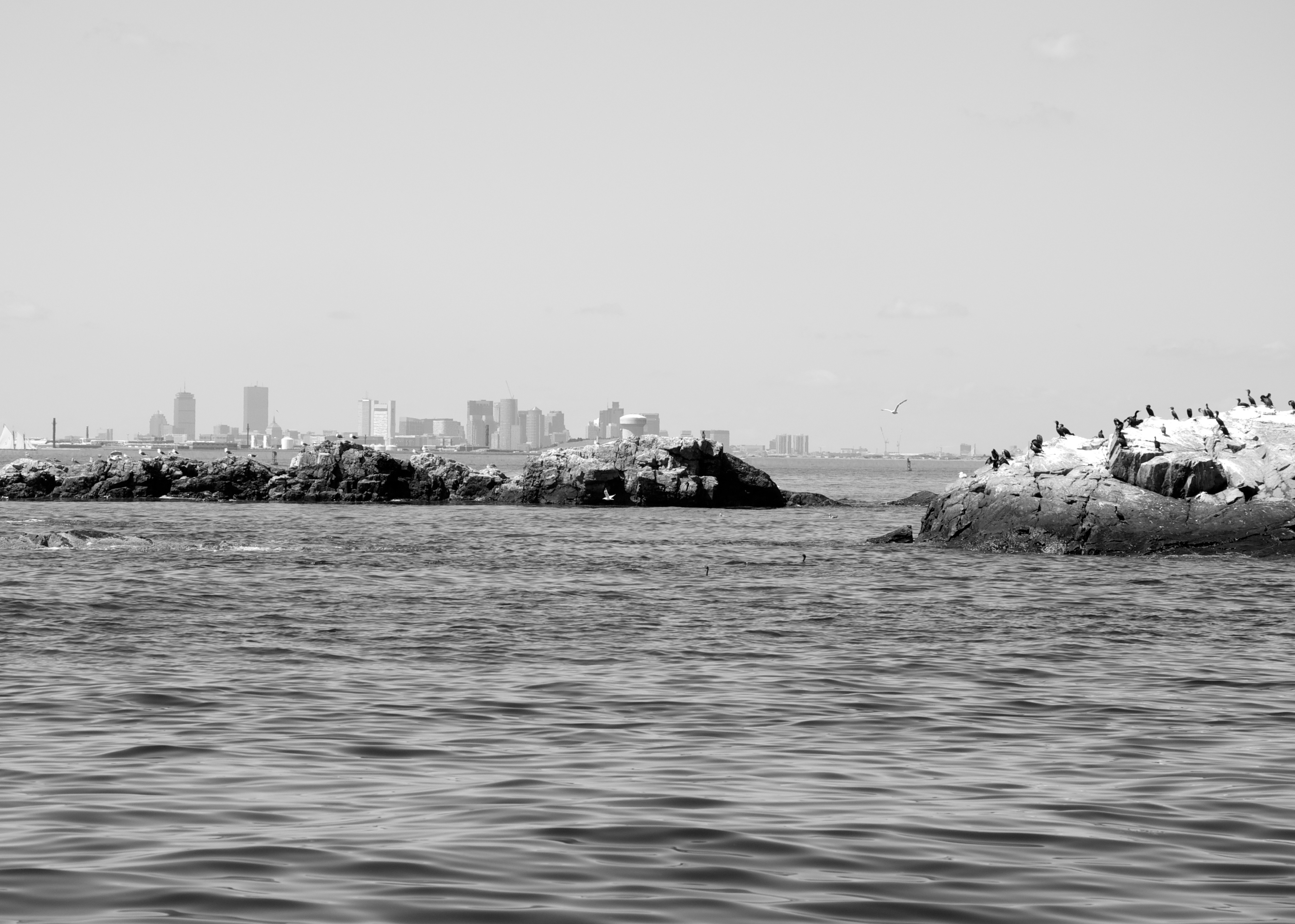
A view from Green Island, looking back southwest toward the city. This is the furthest island from Boston (not counting Graves Light):
A chart of the area around Calf Island, with some notable landmarks mentioned above, such as Green Island, Hypocrite Channel, Little Calf, Pope Rock, and Halftide Rock. The exact location of the chimney is even visible if you look carefully:

*NOAA Nautical Chart. Not for official navigation. See NOAA.gov for disclaimer.


