The view of Boston from Thompson Island, across a small span of Dorchester Bay:

Thompson Island is one of the closest and most accessible of the harbor islands. Located just across Dorchester Bay from the city of Boston, the island is accessible by a regular boat service in the summer months. Unlike the nearby urban island park that is Spectacle Island, Thompson is larger and is less oriented toward the tourist. Below is a view of an airplane landing over Spectacle Island on an autumn evening:

Thompson Island played a role in initial European settlement of Massachusetts, from its initial exploratory visit by Myles Standish in 1621 to its establishment of a trading post by David Thompson in 1626. The island had previously been settled by Native Americans who revered the place for its large rock outcrop, known as Chappel Rock or Squaw Rock (photos of this below). For a more thorough and complete historical overview, Thompsonisland.org has an excellent summary.
The island’s strategic location close to shore and the mouth of the Neponset river likely made it desirable to fishermen and traders. Today, the island can be relatively easily visited from Boston and Quincy: It serves as a summer camp and is open to the public on Sunday in season. And it is still a great place for fishing- especially near the mouth of the salt marsh on the Southeastern side. Pictured below, the drumlin on the Island’s north side gives perspective of Thompson’s relatively close proximity to the city of Boston:

A view of Thompson Island and the city from North Squantum, a part of Quincy just south of where the Island is separated from the mainland by a narrow and shallow channel. The structure in the foreground is an old tower and Nickerson park.

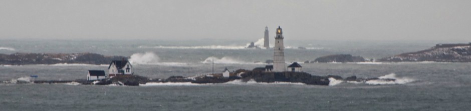
Navigating around the island is relatively straightforward, with the exception of the island’s south side, which has a sand bar to shallow for most boats to pass. Additionally, the island’s East side, while secluded and calm is shallow and a bit rocky. The waters off the north side of the island, just west of Spectacle Island are some of the busiest and choppiest in the harbor given the converging currents.
The shores of Thompson Island are gradually sloping, especially those to the East: Tidal flat extend several hundred yards beyond the shoreline at low tide. Pictured below is a view looking east over Quincy Bay at Thompson’s flats near low tide:

An expansive inlet and salt marsh lies on the Southwestern side of Thompson Island. Such a secluded sanctuary for wild and aquatic life is rarely seen so close to the center of a major city. During summer months, the area of Dorchester Bay between this marsh and the nearby entrance to the Neponset River is teeming with minnows and porgies.

Some of Thompson Island’s indigenous residents: A big flock of turkeys! Look carefully and you will see them….In addition to turkeys and the usual squirrels and chipmunks, Thompson Island is said to be home to a population of deer, coyotes and skunks.

A Blue Heron searches the water line around Thompson Island for a snack:

Down on the farm: If you read about the complete history of Thompson Island in the links above, you would know that it was once a working farm. The remaining walls of what was once a working farm house on the island can be seen to this day:

The main entrance to the old farm house is still fairly in tact. You can see an old photo of the farm as it used to look here, on the fbhi.org website. Today, the camp portion of the Island is full of several working structures including meeting space and lodging, in addition to two tall climbing structures (also part of the camp) that are visible from the mainland.

Below is a photo of a man digging for clams (or treasure?) in the distance as dusk falls at low tide on a cloudy fall evening. The island’s remote and desolate feel stands in contrast to the bright lights of Dorchester and the Southeast Expressway just across the bay:

Chappel Rock, also known as Squaw Rock: This is the point which separates Thompson Island from the mainland. At low tide, the large sand spit seen below is exposed:

Among the many treasures of Quincy’s Thomas Crane Library is a photo of the spit and Thompson Island taken in June 1919. This photo is part of the library’s Samuel Warren Parker Collection. A view of the Long Island Bridge from Thompson’s grassy shores:

Looking west on a Gloomy Fall night, the illuminated JFK library in Boston comes into view to the west across the flat and still expanse of Dorchester Bay:

A distant view of Thompson Island looking South from the top of the North Drumlin of Spectacle Island on a cloudy summer day:

A winter time view of Thompson Island in the foreground and the city of Boston in the background, as seen from the birch-lined forest of Quincy’s Nickerson State Park:

The Thompson Island Ferry, against its namesake island, heading back to its dock at South Boston’s Reserved Channel on a late season fall day:


