Historic Place of the week: The Canton Viaduct

The strange looking structure spanning the Canton River….

Neponset River

Originally built in 1835 based on an ancient roman architectural design, the Canton Viaduct remains in service today as a bridge supporting Amtrak and commuter rail tracks. In accurately emulating the original design, the bridge is extremely strong- nobody knows how much weight it might actually be able to support. Yet, it allows a massive locomotive to traverse above while still not inhibiting the flow of the Canton River, a tributary of the Neponset River. The design was so sophisticated for its time that it was said that during the construction of The Moscow-St.Petersburg railroad, Tsar Nicholas sent his engineers to study the Canton Viaduct for use of its design.

The structure is quite logically suited to this tributary location. The town of Canton was incidentally named for the (perhaps not widely held) late 18th century belief that its location was on the exact opposite side of the earth from Canton, China, which was a popular New England trading port at the time. Its location connected it to the sea via the small Canton River which flows into the Neponset just to the Northwest of the town. The viaduct allowed the heavy trains of the Boston and Providence railroad to fly overhead while permitting the controlled flow of water to to continue to factories and mills located just upstream. A spectacular photo of the viaduct and industry located upstream can be seen here. Today, the Canton Viaduct continues to provide its important role, and like the town, it still holds its name, although we know that the theory of its antipodal proximity to Canton, China was off by several thousand miles to the North of its actual location.

 A clear reflection of the structure from the river’s pool on its upstream side below. Quite a gaggle of geese are known to gather here:

Viaduct

Looking up the large wall of the Canton Viaduct to see the rail tracks above:

rail bridge

The inner stone arches of the viaduct, which also open for automobile access as a main road runs through the viaduct. The viaduct is built from granite extracted from a nearby quarry, which now lies within the Borderland State Park in the town of Easton:

underneath

Posted in Boston Harbor History, historical place of the week | Tagged , , , , | Comments Off on Historic Place of the week: The Canton Viaduct

Historic Defensive Forts of the Northeastern Waterways

Military structures of past eras line the waterways of America’s East Coast and tell a story from a geopolitical and strategic perspective. Like Boston Harbor’s many famous forts were built for the purpose of defending against seaborne invasion, many others are located across the Northeastern United States near strategic waterfront locations. Looking at where these forts were built and why the place was of strategic gives an interesting view into the past. Here are several outside the Boston area that stand out:

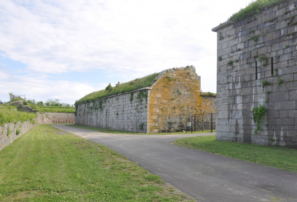
Fort Ticonderoga, NY: One of the oldest fortification structures in America, Ticonderoga sits strategically in the middle of the Champlain Valley of Upstate New York.  The valley extending from the St. Lawrence and down to the Hudson is one of the only flat passages through the Appallacian Mountains between Canada to Georgia. As such, this location was of strategic importance to both French and British interests at the time it was built, as the former controlled the territory to the North, and the latter the territory to the South. More on the great history of Ticondergoa can be seen here, including its role in the Evacuation of Boston Harbor in 1776. Ticonderoga offers majestic views of Lake Champlain and Lake George and the great hills which divide them:
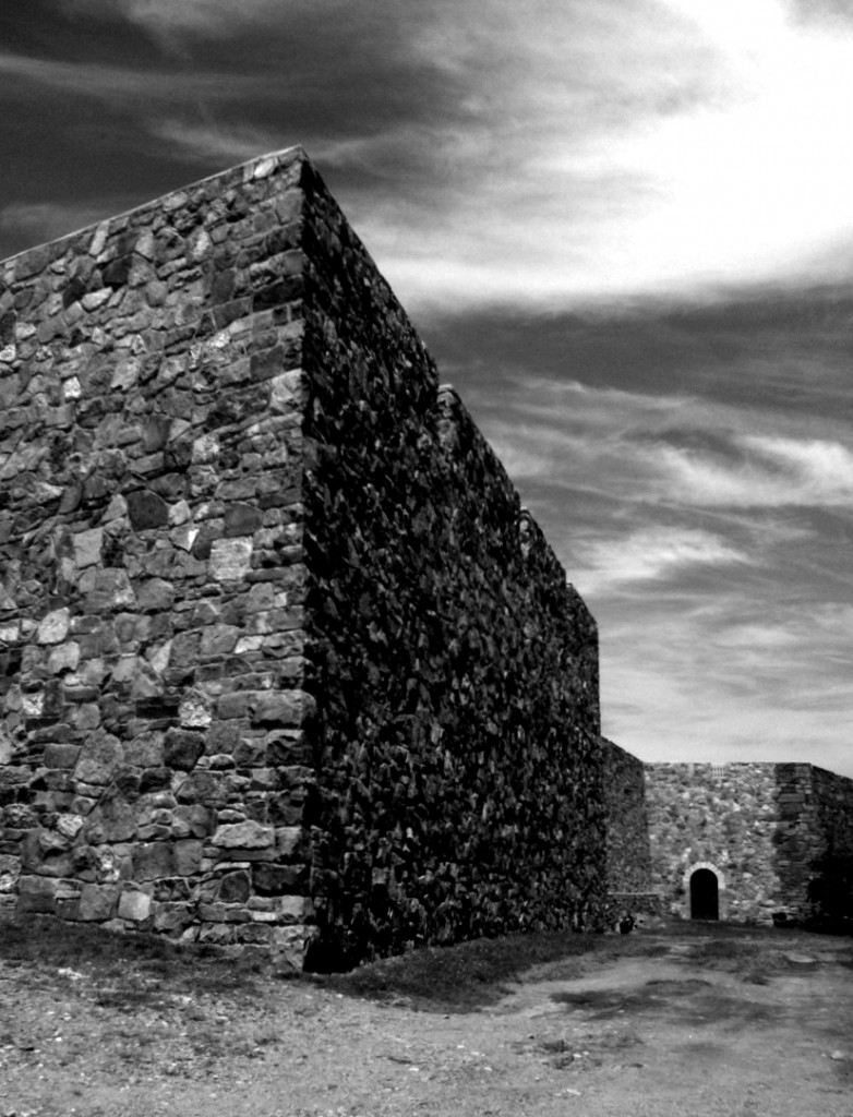
fort

Pictured above is the great walls of Ticonderoga, while below is a view of the strategic location overlooking the northern end of Lake George and the Hudson River Valley:
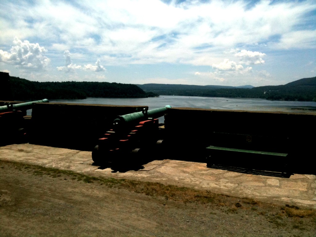
hudson

Fort Ontario, NY: This fort lies on the shores of Lake Ontario in Oswego, a small town in Northern New York. As Ontario was accessible to the French through the St. Lawrence river, this stronghold was designed to protect British Interests in the interior of New York State. Below is a photo of a lake effect storm rolling in from over lake Ontario.
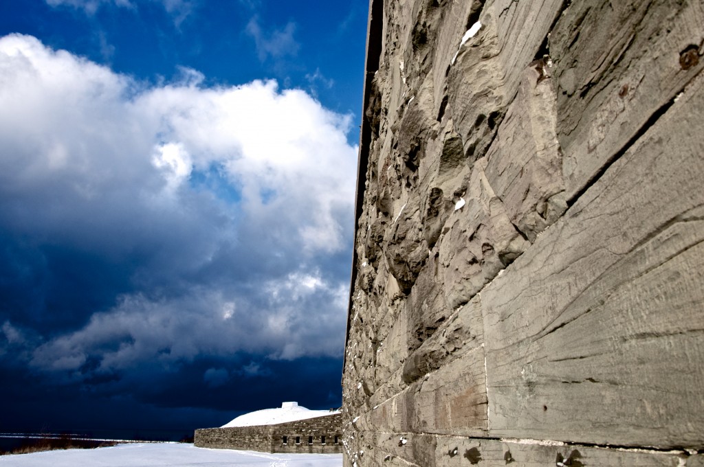
boston

The lighthouse at the mouth of Oswego Harbor against the backdrop of Lake Ontario:
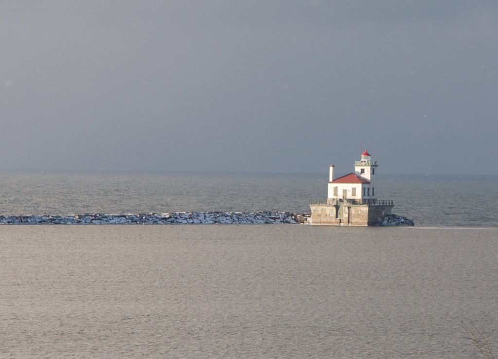
oswego

Fort Stark, NH: This fortification was constructed to defend the city of Portsmouth, NH. It is situated in the town of Newcastle, which is just east of Portsmouth. The city is one of the most Northeasterly major ports on the coast, therefore making it strategic in any Naval conflict with a European power. It was in Portsmouth, NH that a German U-boat crew surrendered and was captured in May 1945.  Here is a more detailed history of the fort.
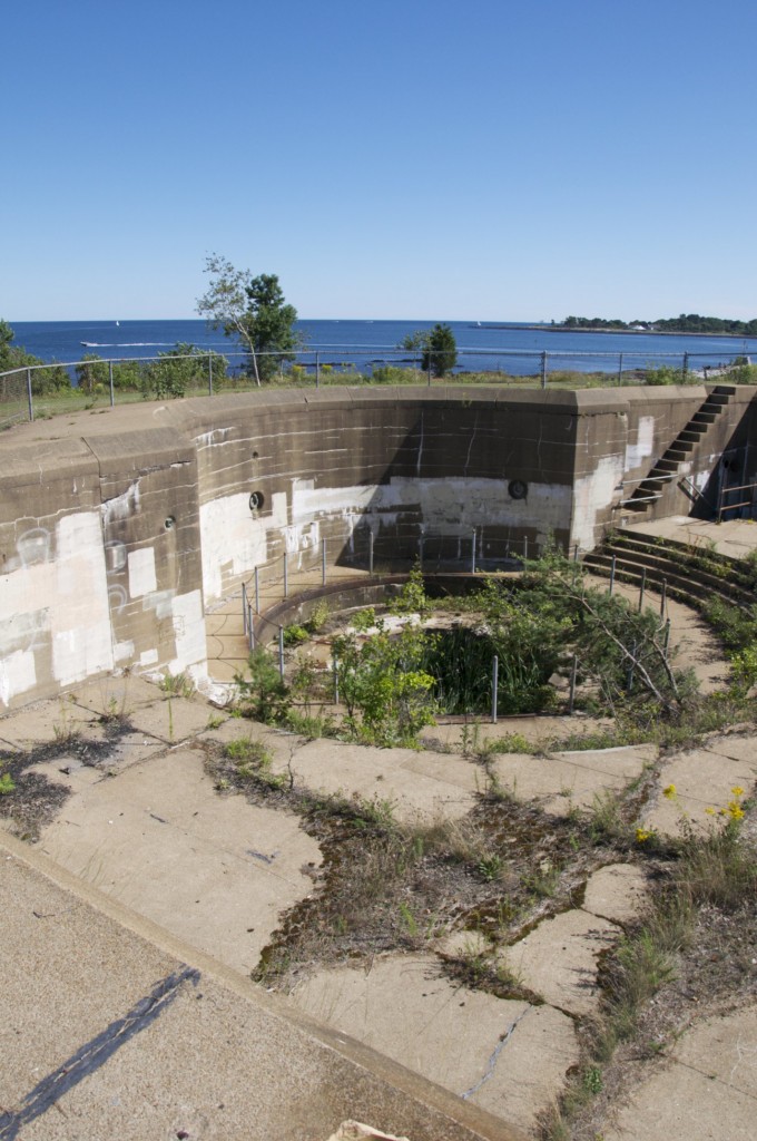
new hampshire

One of the site’s several batteries, which dates back to 1905 per the sign:
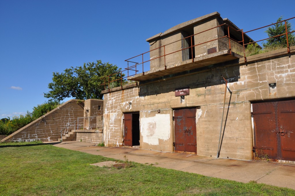
new hampshire

The Lighthouse at Portsmouth Harbor, as seen from the grounds of Fort Stark. Fort Constitution, a smaller abandoned structure can be seen to the left of the lighthouse. Located further into the harbor, it was a part of the same defensive system:
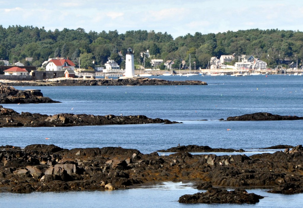
fort stark

Fort Adams, Newport, RI: This very large structure was built around the same time as Fort Warren. The massive granite complex was built to defend Newport Harbor and the large inlet of Quonset Bay. One can visit the grounds to take a tour and spend some time walking around the huge circumference of this tremendous building.
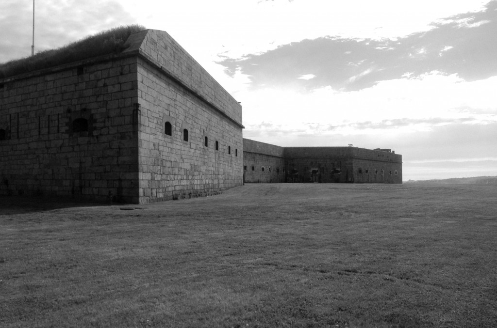
fort adams

The inner walls of the site:

newport

The exterior grounds are wide and well landscaped, providing a scenic walk for visitors:
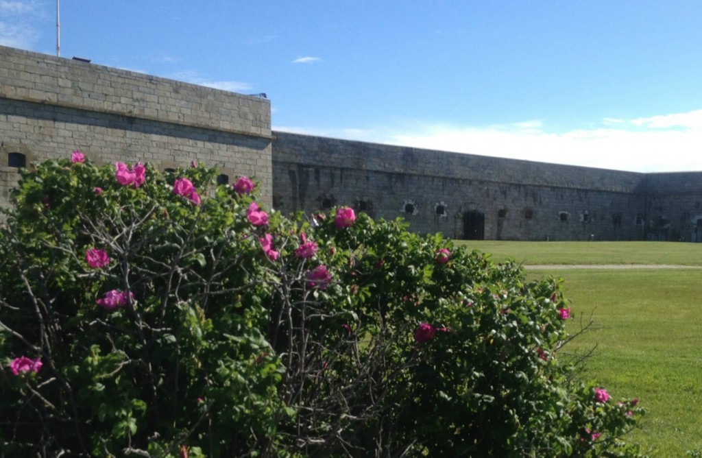
fort adams

The view of nearby Newport Lighthouse Station and the massive Jamestown Bridge:
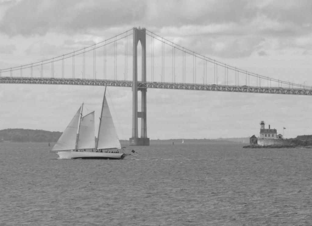
newport light

Fort Taber, New Bedford, MA: This old fort contains a lighthouse sits at the bottom of Clark’s Point, a long peninsula to the west of New Bedford that extends into Buzzard’s Bay. Also built in the Civil War era, the purpose of this structure was to guard the city of New Bedford– which was at the time a city of great economic value to the United States. Today, the fort is surrounded by a park which is open to the public. Read about the fort here.
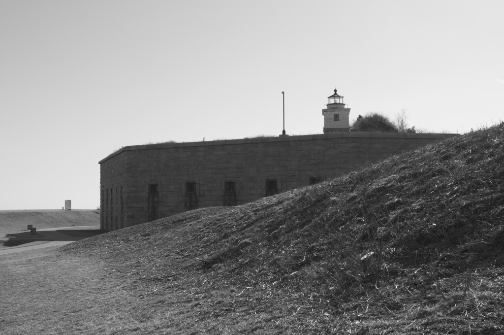
New Bedford

Fort Trumbull, New London, CT: This massive fortress lies at the mouth of the Thames river as it empties into the Long Island Sound. This is probably the most impressive of the several fortresses lying along the Connecticut Coast. The structure was completed in 1777 and was named after Governor Jonathan Trumbull, who presided over its construction. During the Revolutionary War, the fort was attacked and captured by British forces under Benedict Arnold- a surprising feat given the structure’s high walls and defensive capacity. A more detailed overview about the fort can be read here.
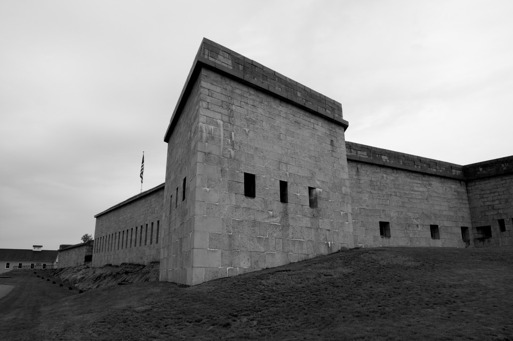
New London Fort

A view from Fort Trumbull of the New London Light House, which is said to be haunted:
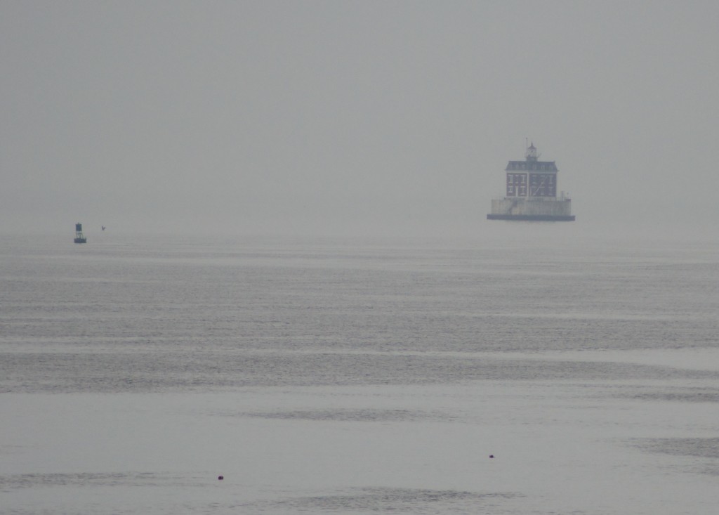
Haunted Light House

Fort Trumbull’s imposing walls against the backdrop of Long Island Sound:
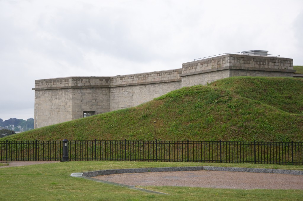
New London

Posted in Boston Harbor in the Winter, historical place of the week, Off course, Uncategorized | Tagged , , , , , , | Comments Off on Historic Defensive Forts of the Northeastern Waterways

Highland Light: Truro’s Outer Beacon

Highland Light sits on the highest dunes of North Truro on outer Cape Cod. It is appropriately named, as these dunes reach heights of over one hundred feet in some places. The lighthouse was built in 1797 in response to the great number of shipwrecks occurring on the desolate sandbars and shoals of the outer Cape. The lighthouse was since moved inland due to erosion, but its original location nearby is still visible today:

truro

Sitting at a total height of 168 feet above the mean sea level, the lens should be visible for about 22 nautical miles to sea in good conditions. The lighthouse was once fitted with a fifth order fresnel lens- the most powerful of its kind. The lens has since been replaced with a more modern by less powerful one. As  result of its prominence above sea level, it had often been the first sign of land to be seen by mariners approaching the New England coast from Europe. It was documented that the standard practice of mariners- from colonial days through the 20th century- coming to the Boston area from Europe would head South of Sable Island until they saw either Cape Cod’s Highland Light or Cape Ann’s Thacher Island Light on the horizon.

national seashore

The lighthouse was originally built by the orders of General George Washington in 1797 in response to the great number of shipwrecks in the area. As Henry David Thoreau discovered during his July, 1855 journey to Truro, had once been incorporated as “Dangerfield” in 170o, likely because of its location’s danger to passing ships.

The location of Highland Light on a nautical chart of Cape Cod. This area is where the Cape’s shore begins to shift to the Northwest. It is known for its high dunes, sandy shoals and strong surf pounding desolate beaches :

truro

Source: NOAA Nautical Chart. See disclaimer at NOAA.gov

A hazy view of downtown Provincetown from across the dunes. The top of the highlands provides a great view not only of the Atlantic Ocean, but other parts of Cape Cod as well. The monument at Provincetown is particularly visible in the distance:

boston

An wide ocean view looking East from high up on top of the dunes near Highland Light. With the dunes being about one hundred feet above sea level at this point, it is easy to lose perspective of the sea below- the waves in the photo are 3-5 feet tall:

truro

Highland Light as seen up close from its base. While the lighthouse may be portrayed as glistening, bright and white in post cards, note the grit and dirt that can be seen on its base from the years of exposure to the North Atlantic Ocean:

truro

Below is a view of the North Truro Air Force Station, which is adjacent to the Highland Light area. This location was ideal for a large radar system given its high cliffs overlooking open water. It is said that the radar dome at this base is powerful enough to monitor the entire North Atlantic, and was a strategic tool of the military during the Cold War. The castle-like tower to the right of the radar structure is the Jenny Lind Tower.  As the legend goes, famous opera singer Jenny Lind once climbed the tower to sing, thereby averting a riot that was about to occur by those shut out of her sold-out show. The tower was moved here is 1927 by a wealthy land owner, for what reason God only knows.

truro

A gritty shot taken from sea of a yacht passing the highlands, with the radar tower and Highland Light distantly visible:

highland light

The lighthouse in its current location moved back from the water, looking West. Also visible in this photo is the museum, which is open for visitation seasonally. For more information about the museum, check out the Truro Historical Society web page.

truro


Posted in Boston Harbor History, Boston Harbor in the Winter, Boston Harbor Navigation, historical place of the week, Uncategorized | Tagged , , , | Comments Off on Highland Light: Truro’s Outer Beacon

Mystic River Bridge

A view of the Mystic River Bridge from East Boston on a cool rainy spring day:

Boston Harbor

Posted in Boston Harbor in the Winter, Boston Harbor Navigation | Tagged , , | Comments Off on Mystic River Bridge

Historic place of the week: The Winslow House

Marshfield’s Winslow House, located just a walking distance from Green Harbor, was a notable part of the history of Massachusetts Bay history. It was once the home of the founding family of the town of Marshfield, and remains very well preserved today. The Winslows were decedents of Mayflower passengers, and settled for several generations in this house that they built in 1699:

Marshfield

Marshfield’s importance to the early days of the Massachusetts Bay colony emerged from not only its water access and proximity to Plymouth Bay, but also its rivers. The area of the town contains both the North River and South River (the latter being the outlet to ocean until being reshaped in the Portland Gale of 1898). These rivers provided passageways inland and were later major centers of ship building. Today, the town has a large historic district with many well preserved buildings.

The house is open to the public as a museum for the season starting in May. It has a very good website which describes the history of the house and notable members of Winslow Family, who were for several generations prominent figures in Colonial America: From Judge Issac Winslow, Grandson of a Mayflower Passenger, and General John Winslow, who was a loyalist British Army officer prior to the outbreak of the American Revolution, and was noteworthy for leading the Acadian evacuation from Nova Scotia in 1775.

Posted in Boston Harbor in the Winter, historical place of the week, Uncategorized, Visiting Boston Harbor, Weather | Tagged , , | Comments Off on Historic place of the week: The Winslow House

Winter on Massachusetts Bay

With what seems like the longest New England winter in a decade nearly over, here is a look back some photos of harbors, lighthouses and ocean views that were taken around Massachusetts Bay over the past several icy, cold months. Massachusetts harbors and bays keep working through the cold, although they feel desolate at this time of year.

Harbors: Rockport Harbor from T Wharf on a cold February afternoon. The fishing fleet in this harbor is still active and ready to go:

fishing boats

Cohasset harbor on a still winter afternoon. Looking out towards Minot Light, the sandbar of Bassings Beach is visible due to low tide:

cohasset winter

Scituate Harbor on a bitter cold, blue sky afternoon:

ma

Green Harbor in Marshfield is far more quiet than normal at this time of year:

duxbury

A trawler heading out past Bulter’s Flatts in New Bedford on a windy afternoon. This photo is actually from last winter, but I thought it worth including.

butlers flats

A large container ship gets unloaded in Boston’s Reserve Channel on a winter afternoon:

ship

Looking out toward Straitsmouth Island on Cape Ann on a cold, windy afternoon:

gloucester

A fishing boat heading out toward the Elizabeth Islands from New Bedford Harbor on a relatively calm winter day:

butlers flat

The shelter of Plymouth Harbor in front of Gurnet Point on a cold sunny afternoon:

Plymouth Harbor Winter

Gloucester’s windswept Eastern Point Lighthouse from the Dogbar breakwater:

gloucester

Baker’s Island as seen from Willow Park in Salem:

bakers island light

Ice Covered Rocks of Salem Sound in January:

salem

The Light at Derby Wharf, Salem:

salem lighthouse

Boston Light as seen across Nantasket Roads from Hull during a January storm:

storm

Ice-covered Minot Light following the same January Storm:

winter

Scituate Light at the end of Scituate Harbor on a cold day:

scituate harbor

The Bristol Coast: A view of Bird Island Light and Cleveland Ledge in the background as seen from Marion on a winter day. Bird Island lies relatively close to the southern end of the Peninsula, while Cleveland Ledge sits further out in the middle of Buzzard’s Bay:

buzzards bay

A snow-covered Ned’s Point Lighthouse in Mattapoisett, Ma.

mattapoisett

For more views of Winter on the Massachusetts coast, see Winter on Cape Cod. And Martha’s Vineyard in the Dead of Winter.

Posted in Boston Harbor in the Winter, Boston Harbor Picture of the Week, historical place of the week, Uncategorized, Visiting Boston Harbor | Tagged , , , , , , , | Comments Off on Winter on Massachusetts Bay

Picture of the Week: Hingham Bay on an early spring day

fishing boat

This was taken from Webb Park overlooking Hingham Bay on a blustery, cold March day.

Posted in Boston Harbor History, Boston Harbor in the Winter, Boston Harbor Navigation, Visiting Boston Harbor | Tagged , , , | Comments Off on Picture of the Week: Hingham Bay on an early spring day

Nut Island: Quincy Bay’s Windswept Eastern Point

Across West Gut from Peddocks Island lies Nut Island, which extends into Quincy Bay. West Gut is a body of water not narrow enough to typically cause a significant torrent as tides ebb and flow. But when a southwest wind picks up against an incoming tide on a summer afternoon tumultuous sea of white caps often ensues as the current rounds Nut Island and Peddocks on its way in from the sea. Through the years, Nut Island has seen many ships in transit to the port of Fore River cutting through fair weather southwesterly winds and strong bay currents.

boston view

Once a testing ground for artillery and later the site of a sewage treatment plant, Nut Island may not have historically been the best known place to observe the natural beauty of Boston Harbor. However, today this protruding land mass, no longer actually an island, is lined with walking trails offering great views of Quincy Bay, the Boston Harbor Islands and the Boston City Skyline. Nut Island extends gracefully from Hough’s Neck in East Quincy into the southern end of Boston Harbor. Once separated from the mainland by water at high tide and an old cow path over a spit at low tide, the path was eventually filled in to make the island fully connected to the mainland. The “island” divides Quincy Bay from Hingham Bay and is separated from Peddocks Island via the West Gut. Due to the exposure to the large Southwestern fetch of Quincy Bay, the area is typically windswept on a fair-weather day.  Pictured above is the view of the Boston skyline to the West across the expanse of the bay. One can see from the Long Island bridge on the right to the Squantum section of Quincy on the left. The bluff in the center is Moon Island.

houghs neck

Quincy’s Nut Island is accessed at the end of Sea Street at the Eastern Point of Hough’s Neck. Pictures below is a map placed on Nut Island outlining the large areas of walking trails in addition to the structures and piers on the island:

boston harbor

A view of nut island against the backdrop of the city skyline, as seen from Hingham Bay:

boston harbor

Water Treatment Plant: Nut Island was once one of the Boston area’s largest water treatment plants. However, by the 1970s and 80’s the plant’s operational and capacity failures became well known. Eventually deemed insufficient to properly handle the amount of sewage coming into the system, the island was replaced with the modern mega-facility on Deer Island. Today, Nut Island still has a functioning pumping system, but all of the wastewater in handles is pumped to Deer Island via a massive underground tunnel. The administrative building of the water treatment plant, which still stands today:

quincy

Testing ground for Cannons: Cyrus Alger (pictured below) was a prominent boston businessman of the mid 1800s. He owned a factory in South Boston which manufactured cannons and heavy artillery. Some history of the factory and its location are well documented here. Alger used Nut Island as a testing ground for his cannons, typically firing them to the Northeast at Prince Head on Peddocks Island.  It is said that a cannon ball fired from Nut Island once missed its target and landed in the old cemetery at Hull.

nut island

A portrait of Cyrus Alger, by Alexander Hay Ritchie. Source: Wikimedia Commons public domain photo.

Today, a remnant of one of Alger’s Cannons remains on Nut Island, and can be viewed by walking around the trails on the North side of the Island. The cannon is pictured below:

Nut Island

Following the days of cannon testing, Nut Island remained a major flounder fishing area.  A detailed history if this industry is featured on one of the island’s many informational posters. While the flounder are no longer as plentiful, the nearby areas of West Gut, Pig Rock and Sunken Ledge remain good flounder fishing areas to this day.

Pictured below is some of the water treatment infrastructure against the backdrop of a frigid harbor. Note the lobster boat in the left side of the photo in front of Prince Head:

boughs neck quincy

 Nut Island as seen from the harbor, approaching West Gut:

boston harbor

An old wharf cleat at the end of Nut Island’s pier. While old and weathered, its manufacturer “Macelroy Co” remains clearly visible:

Boston Harbor

A winter’s view of Quincy Bay from Nut Island:

quincy bay

Posted in Boston Harbor Cruises, Boston Harbor in the Winter, Boston Harbor Navigation, Uncategorized, Visiting Boston Harbor | Tagged , , , , | Comments Off on Nut Island: Quincy Bay’s Windswept Eastern Point

Historic place of the week: The James Blake House

dorchester

The James Blake House is the oldest house standing in Boston today. This may come as a surprise to some, as popular notion holds the Paul Revere house to be the oldest house in Boston, which is incorrect, ad the Blake House predates it by nineteen years. Originally built in 1661, the house now occupies an area off Columbia Road in Dorchester just northeast of the Upham’s Corner area. When it was initially constructed, the house was likely surrounded by woods and pastures, with close proximity to both Dorchester Bay and South Bay given its location in the narrow, northern section of Dorchester.

James Blake was a Deacon and a constable who came to Dorchester with his parents in 1630 from England. The house was most likely built in 1661 according to dendrochronology testing conducted in 2006. This link provides some more detailed information about the history of the house. Below is a side view with the statue of Edward Everett, in his namesake square in Dorchester, visible on the right side.

dorchester

Posted in Boston Harbor History, Boston Harbor Picture of the Week, historical place of the week | Tagged , , | Comments Off on Historic place of the week: The James Blake House

Frozen Charles River

As seen from the roof of the parking garage at the Museum of Science:

Science Museum

Related Posts Plugin for WordPress, Blogger...
Posted in Boston Harbor in the Winter | Tagged , , | Comments Off on Frozen Charles River