Portland Head Light’s location and prominent features make it likely the most scenic lighthouse on all the Atlantic Coast:

Visiting Portland Head Light: White surf pounds the outcrops of rock on a blue sky day. In the foreground is a sweeping horizon with clear deep blue sea below. Behind lies a green park surrounding a memorial to one of the largest WWII era batteries build to defend the city Portland, Maine. This is the kind of stuff I live for!! For this reason, I had to include a post about Portland Head Light to this Boston Harbor−centric blog that this is. However it is easily justified as relevant: Perhaps by the fact that the territory of present−day Maine was part of the Massachusetts Bay Colony until it was incorporated as its own state in 1820. Overall, this is not only one of the most beautiful views on the planet, but is a great piece of New England’s nautical and military history.
The Light is located at a point at the end of Fort Williams Park, an old military fortification now converted into a large park with great green lawns, and sweeping views of both Portland Harbor and the Atlantic Ocean. Since colonial times, this little outcrop of rock served to guide ships safely into Portland; a port separating the open and treacherous Atlantic from the rich and highly desired land and timer resources of the inner lands. It was from these waters that explorers to the new world first sited the great white peaks of what is now New Hampshire’s Presidential Range; (At only 90 miles, Mount Washington is clearly visible from Casco Bay on a clear summer day). Scanning the horizon to the North, one sees land outcrops of rocky peninsulas that appear across the plain, interrupted by gaps of empty horizon: These are the bays and sounds that run deep up toward Maine country. This land was etched by glacial force and the carving torents of the forceful Androsscoggin and Kennebeck rivers as they carry the melted snows from The White Mountains down to the Atlantic.
Military history: Fort Williams was the outpost protecting Portland Harbor. The fort was positioned to guard the main entrance to the harbor: a narrow channel between Cape Elizabeth and Cushing Island. A view from the top of Fort William includes that of the fort itself, as well as Fort Georges in the distance, built on its own island. Portland was truly a heavily fortified harbor:

Across the entrance to Portland Harbor, toward Cushing Island:

Remains of an old battery, Battery Blair, near the Fort’s highest point:

Ruins of another battery positioned closer to the channel:

A chimney marking ruins of an old building close to the water. Most buildings don’t stand a chance against the raging Atlantic Ocean over time.

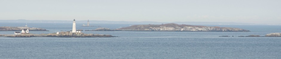
Views: On this particularly clear day, I had a great view of the area surrounding the Lighthouse. Here is a view of Ram’s Head Light, another lighthouse off the coast, which marks a dangerous rock outcrop. This lighthouse is visibly more weathered than the often painted and nicely maintained Portland Head Light.

From the shores of Fort Williams, one can see both lighthouses:

To the South, Cape Elizabeth Lighthouse is visible. This area has a place called Two Lights State Park, not to be confused with the more impressive Portland Head Light.

Further down in South Portland Harbor, Fort Georges is more visible:

South Portland Bug Light, at the entrance to the Harbor:

A final view of Portland Head Light, this time from the West:


