Boston Harbor Picture of the Week: Boston Seaport District

Here is a shot of the Boston Seaport District taken during a sunny afternoon this week. There several new, high end restaurants and bars which overlook the old Boston Fish Pier, seen here:


The Seaport district, also known as the South Boston Waterfront, has seen explosive growth over the past several years, and now offers a variety of high end restaurants overlooking the water. Accessible by boat in the summer season, these places are worth a visit year round.

This is a brief description of facilities for boaters to tie up and dock at the Seaport District. For a more complete list of Boston Waterfront Restaurants, click here.

The places available to tie up your boat include Fan Pier and Liberty Wharf. We recently checked on the details of liberty wharf and found that slips 4-12 are for public use at rate of  $20 per hour with a 6-hour limit. This provides  access to four restaurants right on the waterfront, plus the Bank of America pavilion and other South Boston waterfront restaurants a short walk away. For reservations (recommended), call the dock master  at (617) 999-5996.  Open 10:30am-11pm (no docking after 10pm). Marina Frequency channel 9.0. See the Liberty Wharf website for more details.  Restaurants directly on the water at Liberty Wharf include:

Additionally, a short walk brings you to a variety of other establishments nearby, including Legal Test Kitchen, Morton’s Steakhouse, Rosa Mexacano, The Atlantic Beer Garden, and The Whiskey Priest. As one can see, there are a wide variety of opportunities in Boston’s Seaport District!

Posted in Boston Harbor Cruises, Boston Harbor Day Boat Trips, Boston Harborfront Development, Tour Boats, Visiting Boston Harbor | Tagged , , , | Comments Off on Boston Harbor Picture of the Week: Boston Seaport District

World’s End and the Weir River

A view if the distant Boston Skyline from World’s End:

The image above is taken from World’s End, a reservation area located at the extreme Southeastern edge of the Boston Harbor.

World’s End is a park and reservation in North Hingham which juts out into Hingham Bay. Originally owned by a farmer named John Brewer, this 250 acre sight was once a farm and at one point was even contemplated as a sight for a nuclear power plant. Thankfully, this land was passed over for residential development and has now been turned into a park operated by the trustees of reservations. Hiking up its large gently sloping drumlins provides a sweeping view of the Boston skyline to the West, the Harbor Islands to the North and the Atlantic ocean to the East. World’s End is accessible on road, but the surrounding waters are popular with boaters as well. Large numbers of boats congregate in this area on summer weekends.

One of the many trails throughout the peninsula:

Looking Northeast, out toward Hull and the Atlantic Ocean:


A distant view of the City skyline from the top of the large drumlin on World’s End

Looking Southwest over the field toward the setting sun:

Looking East toward the Weir River Estuary, Nantasket Beach (Hull) and the Atlantic Ocean:

Looking West over the Salt Marshes into a setting sun over Hingham Harbor:

Looking West, toward the “Damde Meddowe”, which intersect with the Weir River. Now returned to its natural state as a salt marsh, this area was once a farmed meadow, created from a large dam across the inlet- hence the name.

A spooky view of the Meadows at dusk:

swamp

Ruins of a structure are visible on the eastern side of the island. This is said to have been the remains of a pump house, and the summer residence of a Boston merchant named Hans Nilson, who spent his weekends on the island until being found drowned here in 1935 or 1936. Nilson was not the only strange hermit in the area. History also tells us* that the Hermit Captain Smith of Grape Island fame lived on a barge on the Weir River, under the old rail bridge to Nantucket Beach, and not far from the area West of World’s End.

DSC_2272

Also located on the west side of World’s End is a location called Ringbolt Rock, which was an area once known for ship building. Evidently the iron ring was used for a tie up for vessels coming through the river. This corroded ring attached to a rock in the area may be the ring bolt that history tells us about:

DSC_2276

The reflection of a calm night on the Weir River near Ringbolt Rock and the Lincoln Rocks:

worldsendpool

The origin of the Weir River, upstream to the old Iron foundry, today known only as Foundry Pond. Remains of a quarry and a dam can still be seen to this day:

foundry

A view of the City of Boston across Hingham Bay and the narrow central neck of Peddocks Island, as seen from World’s End:

DSC_2255

* “Moored in Wier River”, Boston Daily Globe, November 19, 1885.

Posted in Boston Harbor Day Boat Trips, Boston Harbor History, Boston Harbor Navigation, Boston Harbor Walks, Visiting Boston Harbor | Tagged , , , , , | Comments Off on World’s End and the Weir River

Turkey Hill in Hingham, MA

Down here on the South Shore we have a lot of wild turkeys that run around in the woods and occasionally get aggressive. There is even a spot called Turkey Hill, near the Hingham-Cohasset border which was presumptively named for the large number of wild turkeys that can be found running around there.

Happy Thanksgiving to all!


This sight was once the sight of an anti-missile radar control station operated by military during the cold war. The hill now is part of a Massachusetts reservation, and provides stunning views of the Boston skyline and Massachusetts Bay. On a clear day, one can see all the way up along the North Shore- to Salem, Manchester, and even as far as Gloucester. Below is a view of the coastline and Hull’s large wind turbine, as seen from the top of Turkey Hill, looking North East.

To the west lies the Weir River Farm, which is owned by the MA Trustees of Reservations. This is a great view of the Boston Harbor and Boston Skyline. I had to get someone to moooo-ove out of the way before I took this:

boston skyline from wier river farm

Some views looking East from Turkey Hill:

To the Northeast, one can see as far as the end of Cape Ann on a clear day. Below is a highly zoomed in photo of Gloucester, which is distinguishable due to its wind turbines:

Gloucester


A panoramic shot of Hull and Boston Light at the south entrance to Boston Harbor, with the North Shore (Revere) visible in the background:

boston light


A view looking North, with Graves Light to the Left, and the smoke stacks Salem Power Station to the Right:

Turkey Hill


This is relevant to mariners as Turkey Hill is visible very far offshore due to its recognizable radio towers and nearby large water tank. Any captain navigating south of the Harbor entrance at Nantasket Roads should be able to see the twin radios and water tank, and use them as a point of reference while off the shores of Hull, Cohasset or Scituate.

Turkey Hill’s Radio Towers:

The large water tank, also visible from a boat far offshore:

Posted in Boston Harbor Birds, Boston Harbor in the Winter | Tagged , , , , | Comments Off on Turkey Hill in Hingham, MA

Off Course: Extreme conditions on the Great Lakes

A winter storm rages on the Great Lakes- Lake Ontario pictured:

Every once in a while I like to go “Off Course” to mention something that is relevant, if only tangentially, to boating or things nautically or historically relevant. Here is an interesting one about the Great Lakes, as it is not just the oceans where mariners run the risk of deadly storm conditions at sea. It frequently happens on the Great Lakes as well. Don’t believe me? Just ask anyone who knows the story of the Edmund Fitzgerald, a huge iron ore carrier which sank in rough conditions on Lake Superior this week 37 years ago.

While the Great Lakes are not exactly relevant to Boston Harbor area boating, I am writing this post in response to the frequent total disbelief that I encounter when telling New England boaters that wave heights of 15-20 feet can easily be attained on the Great Lakes during rough weather. The reason is wind fetch- the lakes are large enough do that wind blowing over them can get enough unobstructed area to create these huge waves, similar to the ocean. Remember that wave height is a function of wind speed, wind sustainability, and fetch. There are scientific formulas to predict wave height, and they can be seen here.

Here is proof. The photo at the top of this page is of Lake Ontario during a winter, near Oswego, NY. Those below are of Coast Guard ships training in a November gale near the same location, on Lake Ontario’ southwest shore. Look at those brutal conditions:

Below are some Coast Guard boats training on the lake:

The Edmund Fitzgerald was a massive Iron Ore carrier that was lost in Lake Superior 37 years ago this week. The Ship carried the Ore from where it was mined up on the North side of Superior to steel mills on the other side of the lakes, in places near Detroit of Cleveland. These steel mills are strategically located in that they were near the major end market (the Auto Industry) and can access steelmaking raw materials (Iron ore from the North side of Superior, and metalurgical coal from places like Ohio, Pennsylvania and West Virginia). While in the process of making such a run, the Edmund Fitzgerald hit a storm so brutal on the lake that the big ship allegedly broke apart and sank.

Here in this link is an an actual photo of the Edmund Fitzgerald from the NOAA.

Below are some photos I took of a similar vessel, the Cuyahoga, pulling into Cleveland on the shores of Lake Erie:

Close up at dock:

The big ship heading out onto Lake Erie on a calm day:

great lakes

Posted in Off course, Weather | Tagged , , , , , | Comments Off on Off Course: Extreme conditions on the Great Lakes

Boston Harbor Picture of the week: Rowes Wharf

The Rotunda at Rowes Wharf is an iconic structure that represents the gateway from the Boston Harbor into the city’s great financial district. We have previously mentioned the historical Rowes Wharf and colocated luxury hotel, the fabulous Boston Harbor Hotel, which is famous for not only its ambience, but its amazing antique map collection, among other amenities.

Here is a photo of the magnificent Rotunda on a late November afternoon:

Posted in Boston Harbor Picture of the Week | Tagged , , , | Comments Off on Boston Harbor Picture of the week: Rowes Wharf

One Hull of a Sunset

As a large narrow Peninsula jutting out into the Eastern edge of Boston Harbor and separating it from the Atlantic Ocean, the town of Hull is unique to this area in that it has a large Western-facing shoreline. From here, one can look back West and see sunset over the Boston Harbor and the city skyline. Here are some photos of a sunset from the North side of Hull, near Allerton Point, this past Sunday night (11/11). This shot is looking Southwest toward Quincy, with the Blue Hills visible in the back:


Looking South along the inner shore line of Hull’s North side. The boats that continue to remain in the water at this time of the year are mostly the commercial fleet:

Sunset looking North from Fort Revere at the top of Hull ‘s Allerton Point (Here is an earlier photo of the same location at mid day). Note the rays of sun hit Graves light and make it look like it is on and operational, even though it has long been abandoned:


Another view, taken from the exact same location as photo at top of page- only this time it is zoomed out. From here, you can see the tower at Fort Revere on the right side.

Posted in Boston Harbor History, Boston Harbor in the Winter, Boston Harbor Navigation, Uncategorized, Visiting Boston Harbor, Weather | Tagged , , , , , | Comments Off on One Hull of a Sunset

New Bedford: Top American fishing port, legendary whaling capital, work in progress

Along the Southeastern edge of Massachusetts lies the cove where the Acushnet river flows into Buzzard’s Bay. Herein is located the port city of New Bedford – a uniquely positioned city possessing a rich history but an economically challenged present. Once the whaling capital of the United States, as iconically captured in Herman Mellville’s Moby Dick, New Bedford’s whale oil trade peaked in 1860. Manufacturing industries kept the city going until they started to disappear as well during the most recent generation, and the result has been that the city of New Bedford has tragically seen no net population growth in the past two decades. Here are some photos that somewhat capture this great American port city:

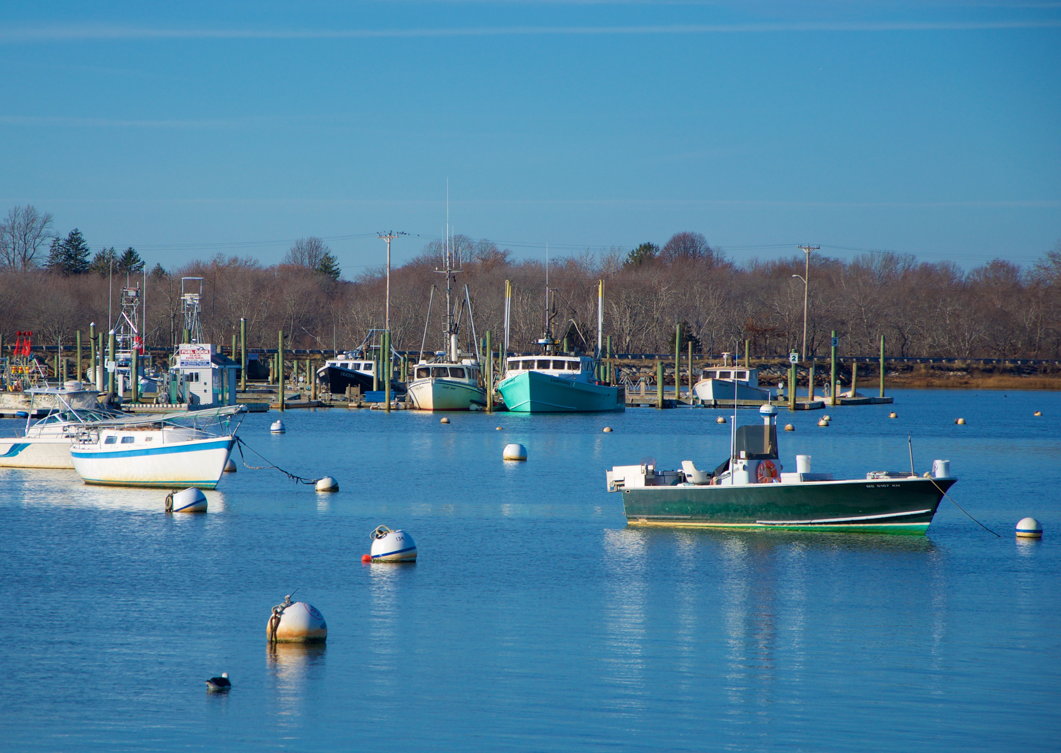
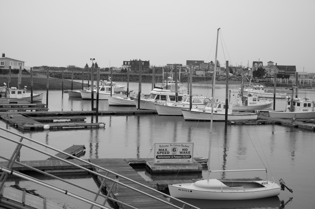
Three western-rigged fishing boats sitting at a New Bedford pier:

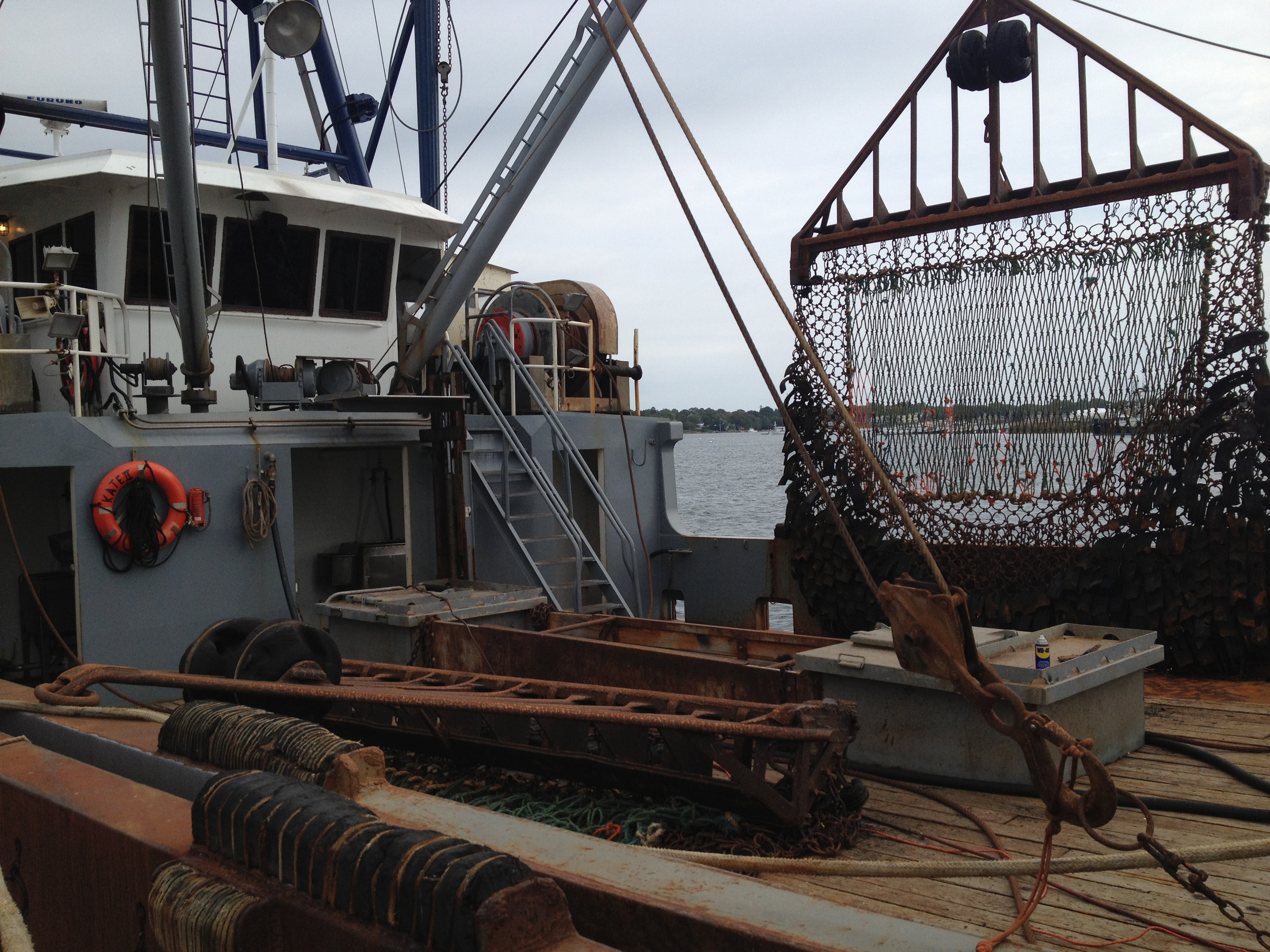
Today, New Bedford is hardly an economically depressed area, as it is a strategically important fishing port. It is the top port in the country for total catch dollar value, while coming in second place on a volume basis after Dutch Harbor, Alaska. Scallops are the major driver of the high catch value, as more than half the scallops imported into the US each year can come in through New Bedford. Here are some photos of a real New Bedford scalloper:


The large drag net up close:

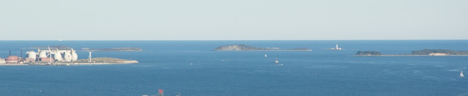
At almost every point, Modern New Bedford offers views that are unique in coastal America. Here, through the harbor, one can get a glimpse of the steeple of a church in Fairhaven, MA, across the Acushnet river sound:

Butler Flats Lighthouse, which sits just outside the breakwater protecting New Bedford’s Harbor from the choppy waters of Buzzard’s Bay:

New Bedford

Old factories like this one on Clark’s Cove line the New Bedford Skyline, remnants of the city’s days of manufacturing might:

Old Factory

Visiting New Bedford by boat may be best done in conjunction with a broader trip to the Buzzard’s Bay area. Boaters will certainly appreciate the access that this area provides to Nantucket Sound, Woods Hole, The Cape Cod Canal, and open Atlantic ocean directly to the south. To the North, the coast of Buzzard’s Bay is filled with marinas such as Barden’s Boat Yard in Marion, MA which offer transient slips and more leisurely, less commercial atmosphere than the City of New Bedford. The chart below shows New Bedford’s location relative to Buzzard’s Bay:

Buzzards Bay

All chart clips contained herein are NOAA Nautical Charts. Not for offcial use or Navigation. See disclaimer at NOAA.gov.

Visting New Bedford

Below is a photo of 1st Street in downtown New Bedford, location of the Mariner’s Home and Seaman’s Bethel, setting of the earlier chapters of Melville’s Moby Dick. This is the place to which Melville reflected that “…nowhere in all America will you find more patrician-like houses; parks and gardens more opulent, than in New Bedford”.  The area is quite well preserved and is worth visiting for the historical sights as well as the New Bedford Whaling Museum.


The church of St. Anthony of Padua. Built in 1902 to primarily serve New Bedford’s French Canadian Catholic Population, this imposing structure continues to hold the title of the tallest church steeple in all of New England:

new bedford

Downtown New Bedford retains the historic buildings and cobblestone streets reminiscent of the period in which it was the whaling capital of the world:

New Bedford Historic District

 This skeleton of Sperm Whale – the primary species targeted during the heyday of the Whaling industry- is one of the many real whale skeletons on display at the New Bedford Whaling Museum:

New Bedford Whaling Museum

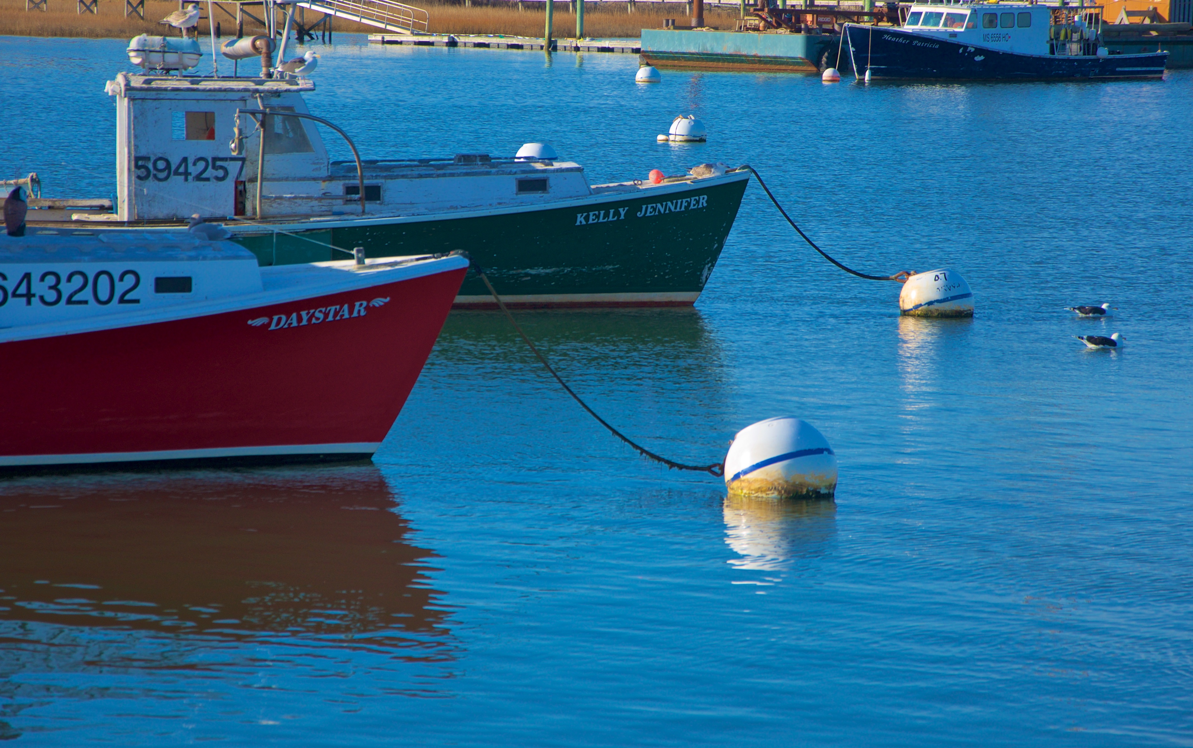
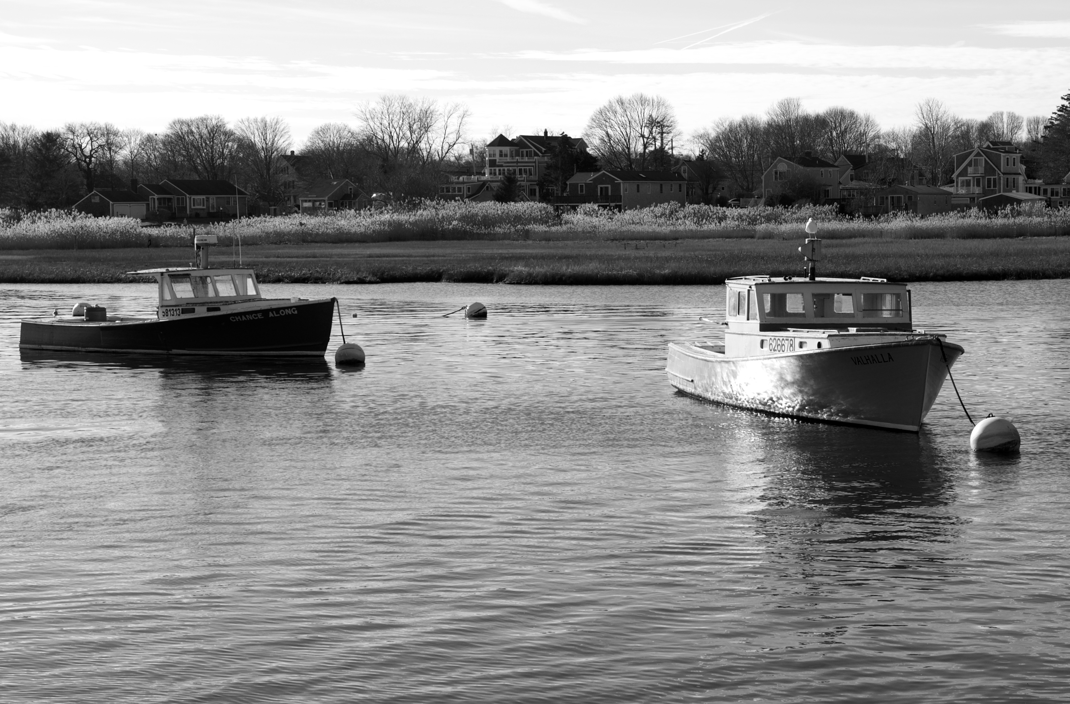
 Fishing vessels lined up in New Bedford Harbor on a blustery cold fall afternoon:


Posted in Boston Harbor Day Boat Trips, Boston Harbor History, Boston Harbor in the Winter, Boston Harbor Navigation, Uncategorized, Visiting Boston Harbor, Weather | Tagged | Comments Off on New Bedford: Top American fishing port, legendary whaling capital, work in progress

Views of Green Harbor and Brant Rock

Green Harbor, an inlet in South Marshfield is a year round commercial fishing port. The nearby village of Brant Rock was reportedly the location of the first radio transmission. 

DSC_1758

DSC_1759

Recreational boating season is largely over by early November, but Green Harbor is a year round operation, with commercial fishing and lobstering operations lasting through the winter. Located at the Southern tip of Marshfield, Green Harbor is one of the coolest and most laid back fishing ports on the Massachusetts Coastline. In addition to its commerical fleet, it has a very nice facility, the Green Harbor Marina, where there are transient spaces available. There are also many charter fishing companies working out of here as well, given the close proximity to Cape Cod Bay and Stellwagen Bank.

DSC_1749

Commercial boats work at Green Harbor through the winter season:

DSC_1755DSC_1951-1024x680

Below Green Harbor, Duxbury beach extends nearly seven miles extends  down to Saquish head. These places are easily accessible from Green Harbor. Once outside Boston Harbor at Allerton Point in Hull, Green Harbor is roughly twenty two miles to the South along the coast. There are a few obstructions offshore that boaters need to be aware of when approaching Green Harbor, such as the Howland Ledge and Bartlett Rock. Fortunately, these are both well marked.

The Green Harbor area contains many sites of relevant nautical history, including the Dyke Road, The Winslow House, a WWII era fire control tower, and the site of the first radio broadcast.

The Dyke Road: According to legend, a local farmer who had travelled to Holland in the mid 19th century came back to Green Harbor with the idea of building a dyke across the harbor to control the tidal surges and improve the arability of the farmland upstream on the banks of the Green Harbor River. The dyke was built in 1872, with the connecting road across it giving citizens of the Brand Rock area better access to Marshfield. However, the construction of the dyke created a great unintended consequence- it greatly reduced the accessibility of the harbor and limited larger vessels from entering the harbor at certain tides. This greatly impacted local fishing fleets and drove local enterprises into great hardship and created a bitter divide in the community. This came to a head when the dyke was reportedly blown up with dynamite one night in the late 1900s! No person was held accountable for this action, and the contention in the community over the dyke evidently slipped into historical obsolescence, but the dyke road in Marshfield remains a major thoroughfare today connecting Marshfield center to Brant Rock. Pictured below is the dyke in modern times:

DSC_1735

The Dyke Road as seen from across the Green Harbor River:

DSC_1730

Fire Control Tower: One of the major fire control towers on the cost is located at Brant Rock in Marshfield. Similar to other towers located in Cohasset, Hull, Nahant and Gloucester, this structure was part of a system used to spot enemy submarines and fire at them during the WWII. 

lookout

The location of the first radio broadcast: The first Radio transmission was made by a scientist named Reginald Fessenden in 1906. At what is now known as Blackman’s Point at the southern tip of Brant Rock, Fessenden constructed a tall radio tower which was used  to communicate with another radio tower in Scotland. The base of Fessenden’s tower remains today, with a historical marker describing its significance. A photo of the tower during its operation can be seen here, but the remaining base is pictured below:

tower base

The monument to Fessenden’s Broadcast: 


IMG_3134

A chart of the area: Green Harbor all the way down to Duxbury Bay: 

Source: NOAA nautical chart. Not to be relied on for navigation. Please download the full version from “www.charts.noaa.gov” and see terms of service at http://www.charts.noaa.gov/RNCs/Agreement.shtml?13270.
Posted in Uncategorized | Tagged , , , , , , , | Comments Off on Views of Green Harbor and Brant Rock

Boston Harbor picture of the week: Beach Houses

A neat angle on some oceanfront beach houses in Scituate, taken after Hurricane Sandy had passed last week:

Posted in Boston Harbor Picture of the Week, Uncategorized | Tagged , , | Comments Off on Boston Harbor picture of the week: Beach Houses

Gloucester fishing boat washes up on Cohasset shores after storm

This week’s Nor’easter, packing wind gusts up to 50mph, swept a Gloucester fishing boat all the way across Massachusetts Bay. This morning, while driving down Jerusalem Road in Cohasset, I was surprised to see the boat was still there, so I took these pictures from the street (the vessel appears to be on private property, so I couldn’t get much closer). The location of this vessel is near the intersection of Jerusalem Road and Atlantic Ave. Evidently, the boat broke from its mooring in Gloucester’s Magnolia Harbor, which is just over 22 miles away!

Here is the Gloucester Fishing Boat David & Jenna, washed up on the beach in Cohasset.


11/17 Update: Fast forward a week and the vessel has been salvaged from the Cohasset beach. Her name is David & Jenna, which i discovered recently. Allegedly, after heading out to sea, the engine overheated from a damaged impeller (which runs the water cooling system). This would not be surprising given that the boat was up on sand for quite a few days. She is currently docked in Cohasset’s inner harbor near the Habormaster’s office. I saw her earlier today:

Overall, I think this should be considered a good outcome as there was no damage. Quite remarkable that a Gloucester fishing boat could drift all the way to Cohasset.

The picture below showing Minot Light and the many rocks of Cohasset Cove in the backdrop serves as a reminder that this boat could have faired worse had it hit the nearby Grampus Ledge or Hog’s Head Rocks.


Related Posts Plugin for WordPress, Blogger...
Posted in Boston Harbor in the Winter, Boston Harbor Navigation, Fishing, Weather | Tagged , , , , | 2 Comments